•  

Storm Kathleen Brings Strong Winds, High Waves To Ireland, UK Coasts 2

Storm Kathleen brought strong winds to Ireland, Northern Ireland, Scotland and parts of western England on Saturday, April 6. Videos posted on social media show big waves hitting the coasts across the regions.

  •  
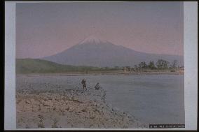
Mt. Fuji seen from the Fuji River

Mt. Fuji seen from the Fuji River

Northeastern view of the snow-capped peak of Mt. Fuji, taken from the bank of Fuji River in Iwabuchi, Fujikawa-machi. The mountain on the left is Mt. Iwamoto, and the tree line reaches to the forest of Matsuoka Sui Shinto Shrine (Fuji City) on the left. Two men are at the riverside, and Fujigawa Bridge, which crosses from the south of the shrine to Iwabuchi, is visible. This bridge was washed away many times from the beginning of the Meiji Period. It is difficult to determine exactly when this photograph was taken.==Date:unknown, Place:Shizuoka, Photo:unknown, (Credit:Nagasaki University Library/Kyodo News Images) [Cabinet Number86‐5‐0]

  •  
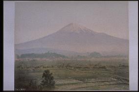
Mt. Fuji seen from Omiya

Mt. Fuji seen from Omiya

Northeastern view of Mt. Fuji from the hillside of Nonaka in Fujinomiya City. The top of the mountain is covered with snow, and Mt. Hoei is visible on the right. The foliage in the centre left is part of Mt. Fuji Hongu Sengentaisha Shrine. The temple town of Fujinomiya (Omiya) can be seen in front. The Uruigawa riverbank crosses horizontally at the edge of the rice paddies.==Date:unknown, Place:Shizuoka, Photo:A. Farsari, (Credit:Nagasaki University Library/Kyodo News Images) [Cabinet Number82‐49‐0]

  •  
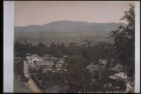
The city of Kyoto seen from Maruyama

The city of Kyoto seen from Maruyama

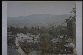
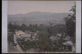
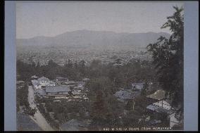
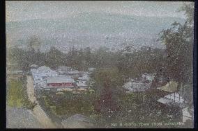
Western view of the northern part of Kyoto from the Yoshimizu Hot Spring building. The road stretching from the centre of the photo to the left corner is the approach to Yasaka Shinto Shrine. Although the site would later become Maruyama Park, no work has been done yet, and a few restaurants stand in the area. A two-story Western-style building of yosemune-zukuri style stands on the northeast side of the street where cherry blossoms would later become a tourist attraction. The Nishiyama Mountain Range is faintly visible in the background.==Date:unknown, Place:Kyoto, Photo:Tamamura Kozaburo, (Credit:Nagasaki University Library/Kyodo News Images) [Cabinet Number80‐3‐0]

  •  
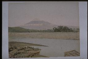
Mt. Fuji seen from the Fuji River

Mt. Fuji seen from the Fuji River

Northeastern view of Mt. Fuji from the bank of Fuji River at Iwabuchi in Fujigawa-machi. The ferry port of Iwabuchi is in the foreground, and Matsuoka Sui Shinto Shrine of Fuji City is visible in the forest on the other side. The bridge between the shrine and Iwabuchi is not visible in this photograph, perhaps because it had been recently washed away, which often happened due to the rapid flow of Fuji River. The mountain on the left is Mt. Iwamoto, and pine trees line the other side of the river.==Date:unknown, Place:Shizuoka, Photo:Tamamura Kozaburo, (Credit:Nagasaki University Library/Kyodo News Images) [Cabinet Number79‐16‐0]

  •  
The city of Kyoto seen from Maruyama

The city of Kyoto seen from Maruyama

Western view of the northern part of Kyoto from the Yoshimizu Hot Spring building. The road stretching from the centre of the photo to the left corner is the approach to Yasaka Shinto Shrine. Although the site would later become Maruyama Park, no work has been done yet, and a few restaurants stand in the area. A two-story Western-style building of yosemune-zukuri style stands on the northeast side of the street where cherry blossoms would later become a tourist attraction. The Nishiyama Mountain Range is faintly visible in the background.==Date:unknown, Place:Kyoto, Photo:Tamamura Kozaburo, (Credit:Nagasaki University Library/Kyodo News Images) [Cabinet Number79‐5‐0]

  •  
Kagami-ike (Mirror Pond), Todaiji Temple

Kagami-ike (Mirror Pond), Todaiji Temple

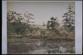
This is Kagami-ike (Mirror Pond) located at the southeast of Chumon Gate of Todaiji Temple. Since Mt. Wakakusa is visible afar, this is the view from the Nanboku (lit. South-North) approach to the temple when facing southeast. The stairs at west of Nakashima Island and a torii gate are present. People originally entered from the west, however, at present the entrance is from the back east side.==Date:unknown, Place:Nara, Photo:Usui Shuzaburo?, (Credit:Nagasaki University Library/Kyodo News Images) [Cabinet Number65‐3‐0]

  •  
An entrance to Mt. Suwa

An entrance to Mt. Suwa

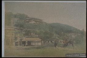
The torii gates of Suwa Shinto Shrine are on the left. The restaurant Tokiwaro, frequented by men-of-letters and politicians, is on the hillside. The observation deck above the restaurant commands a panoramic view of the city and harbour as well as Kii Peninsula and Awaji Island in the distance. The photographs taken from this spot appear in photograph albums, postcards, and guidebooks. The present-day Venus Bridge connects the original observation deck with a new one built above it.==Date:unknown, Place:Kobe, Photo:unknown, (Credit:Nagasaki University Library/Kyodo News Images) [Cabinet Number56‐33‐0]

  •  
Cherry trees at Nogeyama Park

Cherry trees at Nogeyama Park

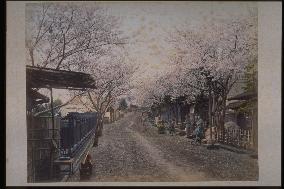
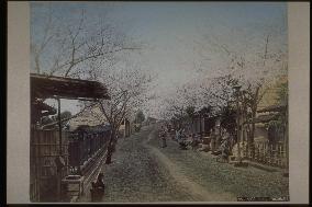
Iseyama Kotaijingu Shrine and Naritasan Yokohama Betsuin (a.k.a. Noge Fudo) were built in 1870 near Mt. Noge. The area attracted many people during the cherry blossom season and in autumn when the leaves turn colour. The mountain summit also commanded a panoramic view of the port and city.==Date:unknown, Place:Yokohama, Photo:unknown, (Credit:Nagasaki University Library/Kyodo News Images) [Cabinet Number55‐39‐0]

  •  
Nogeyama Hill,Yokohama

Nogeyama Hill,Yokohama

Iseyama Kotaijingu Shrine and Naritasan Yokohama Betsuin (a.k.a. Noge Fudo) were built in 1870 near Mt. Noge. The area attracted many people during the cherry blossom season and in autumn when the leaves turn colour. The mountain summit also commanded a panoramic view of the port and city.==Date:unknown, Place:Yokohama, Photo:unknown, (Credit:Nagasaki University Library/Kyodo News Images) [Cabinet Number55‐11‐0]

  •  
Rows of houses seen from Higashiyama,Kyoto

Rows of houses seen from Higashiyama,Kyoto

The city of Kyoto, facing west from the Higashiyama Shogun Mound. The Yasaka Pagoda at Horinji Temple is visible in the left foreground and, in the centre, the precincts of Yasaka Shinto Shrine. The Kamogawa River and Rakuchu area of the city are visible in background with the Nishiyama Mountains behind. Gion Shinchi is on the east side of Kamogawa River. There is significant greenery around the precincts of Ken'ninji Temple, showing that the area had not yet been developed.==Date:unknown, Place:Kyoto, Photo:unknown, (Credit:Nagasaki University Library/Kyodo News Images) [Cabinet Number52‐39‐0]

  •  
The city of Kyoto seen from Maruyama

The city of Kyoto seen from Maruyama

Western view of the northern part of Kyoto from the Yoshimizu Hot Spring building. The road stretching from the centre of the photo to the left corner is the approach to Yasaka Shinto Shrine. Although the site would later become Maruyama Park, no work has been done yet, and a few restaurants stand in the area. A two-story Western-style building of yosemune-zukuri style stands on the northeast side of the street where cherry blossoms would later become a tourist attraction. The Nishiyama Mountain Range is faintly visible in the background.==Date:unknown, Place:Kyoto, Photo:unknown, (Credit:Nagasaki University Library/Kyodo News Images) [Cabinet Number52‐32‐0]

  •  
The city of Kyoto seen from Higashiyama

The city of Kyoto seen from Higashiyama

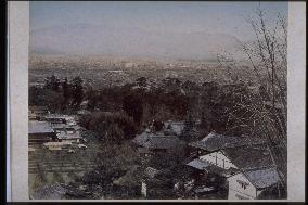
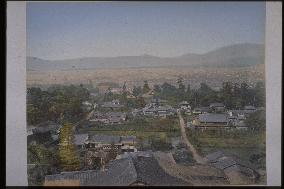
Kyoto is seen from the Yaami Hotel, looking west. The approach to Yasaka Shrine is visible on the right and the approach to the stone torii gate on the left. Restaurants, possibly inns, and also a mulberry field are visible on the area which later became Maruyama Park. The roofs of the worship hall and the main hall of Yasaka Shrine are partially visible in the centre. The Nishiyama mountains are faintly visible in the background.==Date:unknown, Place:Kyoto, Photo:unknown, (Credit:Nagasaki University Library/Kyodo News Images) [Cabinet Number52‐33‐0]

  •  
The city of Kyoto seen from Maruyama

The city of Kyoto seen from Maruyama

Western view of the northern part of Kyoto from the Yoshimizu Hot Spring building. The road stretching from the centre of the photo to the left corner is the approach to Yasaka Shinto Shrine. Although the site would later become Maruyama Park, no work has been done yet, and a few restaurants stand in the area. A two-story Western-style building of yosemune-zukuri style stands on the northeast side of the street where cherry blossoms would later become a tourist attraction. The Nishiyama Mountain Range is faintly visible in the background.==Date:unknown, Place:Kyoto, Photo:unknown, (Credit:Nagasaki University Library/Kyodo News Images) [Cabinet Number52‐22‐0]

  •  
The city of Kyoto seen from Higashiyama

The city of Kyoto seen from Higashiyama

The view of Kyoto from Yaami Hotel, facing west. The approach to Yasaka Shrine is visible on the right and the approach to the stone torii gate on the left. Restaurants, possibly inns, and also a mulberry field are visible on the area which later became Maruyama Park. The roofs of the worship hall and the main hall of Yasaka Shrine are partially visible in the centre. The Nishiyama mountains are faintly visible in the background.==Date:unknown, Place:Kyoto, Photo:unknown, (Credit:Nagasaki University Library/Kyodo News Images) [Cabinet Number52‐21‐0]

  •  
The city of Kyoto seen from Maruyama

The city of Kyoto seen from Maruyama

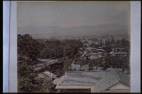
Western view of the southern part of Kyoto from the Yoshimizu Hot Spring building. The Otani Mausoleum of Higashi (East) Otani with its earthen wall is visible on the left, with its approach stretching to the west. The main building of Yasaka Shinto Shrine and the roof of the shrine's irimoya building are visible in the garden. Although the site would later become Maruyama Park, no work has been done yet, and a few restaurants stand in the area. The Nishiyama Mountain Range is faintly visible in the background.==Date:unknown, Place:Kyoto, Photo:unknown, (Credit:Nagasaki University Library/Kyodo News Images) [Cabinet Number52‐14‐0]

  •  
The city of Kyoto seen from Maruyama

The city of Kyoto seen from Maruyama

Western view of the northern part of Kyoto from the Yoshimizu Hot Spring building. The road stretching from the centre of the photo to the left corner is the approach to Yasaka Shinto Shrine. Although the site would later become Maruyama Park, no work has been done yet, and a few restaurants stand in the area. A two-story Western-style building of yosemune-zukuri style stands on the northeast side of the street where cherry blossoms would later become a tourist attraction. The Nishiyama Mountain Range is faintly visible in the background.==Date:unknown, Place:Kyoto, Photo:Tamamura Kozaburo, (Credit:Nagasaki University Library/Kyodo News Images) [Cabinet Number48‐115‐0]

  •  
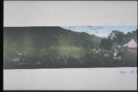
Shrine among mountains

Shrine among mountains

A view from the Fujiya Hotel. The left is the Naraya Hotel, the front mountain is the Myojogatake, and the right corner is the Kumano Gongen. The Odo Bunko which was built in 1894 by Chamberlain, who stayed for a long period at the Fujiya hotel, cannot be seen right under the Gongen, so the photo was probably taken before that.==Date:unknown, Place:Hakone, Photo:unknown, (Credit:Nagasaki University Library/Kyodo News Images) [Cabinet Number46‐183‐0]

  •  
The shrine at the top of Mt. Atago

The shrine at the top of Mt. Atago

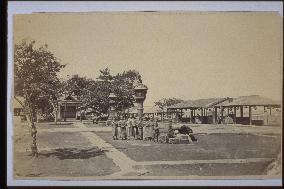
The Atago Shrine was built through donations collected by the Atago Shrine in Kyoto at the top of Mt. Atago. To the left rear is a torii and the building. In front of the big steel lanterns, children look at the camera. A panoramic view is provided from the teahouse to the right. During the Edo era, Mt. Atago was a favorite spot for viewing the moon and snow.==Date:unknown, Place:Tokyo, Photo:unknown, (Credit:Nagasaki University Library/Kyodo News Images) [Cabinet Number24‐42‐0]

  •  
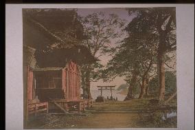
Byobu torii gate at the approach to hakone shrine

Byobu torii gate at the approach to hakone shrine

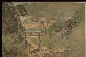
This torii does not stand at present, only a monument next to a petrol station. But it was probably famous during the Meiji era, and many photos remain of this scene. A procession of mountain palanquins and umbrellas is seen, some of the people looking like soldiers. It is scenic spot with a view of Ashino Lake.==Date:unknown, Place:Hakone, Photo:unknown, (Credit:Nagasaki University Library/Kyodo News Images) [Cabinet Number14‐7‐0]

  •  
Arashiyama at hozugawa river

Arashiyama at hozugawa river

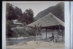
A view of Kunugiya Sozo Shrine from Nakanoshima on the other side of the river. The bargeboard of the shrine can be seen clearly. To the fore of the river, a small thatch-roofed hut is set, with a woman dressed in a kimono sitting on a stand.==Date:unknown, Place:Kyoto, Photo:Ogawa Kazumasa, (Credit:Nagasaki University Library/Kyodo News Images) [Cabinet Number9‐32‐0]

  •  
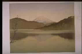
Mt. Fuji seen from Lake Ashi

Mt. Fuji seen from Lake Ashi

Ashino Lake and Mt.Fuji seen from the forefront of Hakone Elementary School. It is a view of the so-called Sakasa Fuji (Mt.Fuji upside down). In the mountain to the right of the lake is the Hakone Gongen. The famous red torii of the shrine was built in 1960 to commemorate the official investiture of the Crown Prince and so is not in the photo.==Date:Middle Meiji, Place:Hakone, Photo:Kusakabe Kinbei, (Credit:Nagasaki University Library/Kyodo News Images) [Cabinet Number3‐42‐0]

  •  
HONMOKU shrine

HONMOKU shrine

The caption reads view of Honmoku near Yokohama, but this is a photo of Honmoku Shrine (Juni Tensha) on the Honmoku beach taken from the mountain side. This shrine was the guardian of Hongo village and became Honmoku Shrine with the Buddhist and Shinto separation in the early Meiji era. Votive pictures of horses can be seen next to the shrine.==Date:unknown, Place:Yokohama, Photo:Kusakabe Kinbei, (Credit:Nagasaki University Library/Kyodo News Images) [Cabinet Number3‐12‐0]

  •  
Mt. Fuji seen from a mountain village

Mt. Fuji seen from a mountain village

Mt. Fuji viewed from around Murayama, Fujinomiya City (?). When climbing to Mt. Fuji from Fujinomiya, travelers stopped at Murayama Sengen Shrine and Dainichi-do in Murayama Village to worship. Since Mt. Hoei can be seen jutting up on the right, it is likely that this photograph was taken in Murayama, but the lack of an object of reference makes it difficult to determine the exact location.==Date:unknown, Place:Shizuoka, Photo:F. Beato, (Credit:Nagasaki University Library/Kyodo News Images) [Cabinet Number104‐4‐0]

  • Main
  • Top
  • Editorial
  • Creative
  • About Us
  • About ILG
  • Terms of use
  • Company
  • BEHIND
  • Price List
  • Single Plan
  • Monthly Plan
  • Services
  • Shooting
  • Rights Clearance
  • Support
  • FAQ
  • How To Buy
  • Contact Us
  • Become a Partner

© KYODO NEWS IMAGES INC

All Rights Reserved.

  • Editorial
  • Olympics
  • News
  • Sports
  • Japan
  • Tech
  • Royal
  • Disaster
  • NorthKorea
  • Old Japan
  • SNS
  • Creative
  • Food
  • Japan
  • Landscape
  • Animal
  • Popular
  • #Ukraine
  • #Thailand
  • #coronavirus
  • #N. Korea
  • #China
  • #Russia
  • #Ukraine
  • #Thailand
  • #coronavirus
  • #N. Korea
  • #China
  • #Russia
  • Food
  • Japan
  • Landscape
  • Animal
  • Olympics
  • News
  • Sports
  • Japan
  • Tech
  • Royal
  • Disaster
  • NorthKorea
  • Old Japan
  • SNS